Are you looking to land your dream job as a Geospatial Analyst? Crafting an impressive CV is your first step towards standing out in this competitive field. In this comprehensive guide, we will walk you through the essential components of a successful Geospatial Analyst CV, providing you with practical tips and an example to help you create a document that truly reflects your skills and experience. By the end of this article, you’ll have a clear understanding of how to present your qualifications effectively. Here’s what you can expect to learn:
- Understanding the Geospatial Analyst Role: Insights into the skills and qualifications that employers are looking for.
- Essential CV Components: Breakdown of the key sections every Geospatial Analyst CV should include.
- Tailoring Your CV: Tips on how to customize your CV for specific job applications.
- Highlighting Technical Skills: Effective ways to showcase your GIS software proficiency and analytical capabilities.
- Showcasing Relevant Experience: Strategies for presenting your work history and projects in the best light.
- Design and Layout Tips: Best practices for formatting your CV to make it visually appealing and easy to read.
- Common Mistakes to Avoid: Pitfalls to watch out for that could hinder your chances of landing an interview.
Dive in, and let’s transform your CV into a powerful tool that opens doors to new opportunities in the field of geospatial analysis!
What is a Geospatial Analyst CV?
A Geospatial Analyst CV serves as a professional document that highlights an individual's skills, qualifications, and experiences in the field of geospatial analysis. The primary functions of this CV are to showcase expertise in geographic information systems (GIS), data analysis, and spatial reasoning, which are crucial for roles that involve interpreting geographical data and creating visual representations. A well-crafted CV not only lists relevant academic credentials and work experience but also emphasizes technical proficiencies in software tools such as ArcGIS or QGIS. For guidance on constructing an effective CV, refer to this cv writing guide.
The importance of a Geospatial Analyst CV cannot be overstated, as it serves as a critical marketing tool in a competitive job market. It allows candidates to present their analytical abilities and problem-solving skills, which are essential in various sectors like urban planning, environmental management, and transportation. A visually appealing and well-organized CV can significantly enhance a job seeker's chances of making a positive impression on potential employers. For those looking to create a standout CV, utilizing a cv maker can streamline the process and ensure a professional layout that captures attention.
Key Components of a Geospatial Analyst CV
- Contact Information: Include your full name, phone number, email address, and LinkedIn profile link to ensure potential employers can easily reach you.
- Professional Summary: A brief overview of your experience, skills, and what you bring to the role of a Geospatial Analyst, tailored to the specific job you are applying for.
- Education: List your degree(s) relevant to geospatial analysis, including the institution's name, location, and graduation date. Highlight any specialized coursework or certifications.
- Technical Skills: Enumerate your technical competencies, including proficiency in GIS software (e.g., ArcGIS, QGIS), data analysis tools, and programming languages relevant to geospatial analysis. For a comprehensive guide on essential skills, refer to our skills section.
- Work Experience: Detail your professional history, emphasizing roles that demonstrate your expertise in geospatial analysis. Include your job title, company name, location, dates of employment, and key responsibilities. More on presenting your work experience can be found in our work experience section.
- Projects: Showcase relevant projects you've worked on, including brief descriptions, your role, the technologies used, and the outcomes or impacts of your work.
- Certifications: List any additional certifications that enhance your qualifications, such as GIS Professional (GISP) or other relevant industry certifications.
- Publications and Presentations: Include any academic papers, articles, or presentations you’ve contributed to, particularly those related to geospatial analysis or relevant fields.
- Professional Affiliations: Mention memberships in relevant organizations, such as the Urban and Regional Information Systems Association (URISA) or the American Society for Photogrammetry and Remote Sensing (ASPRS).
- Soft Skills: Highlight interpersonal skills that are valuable in the role, such as problem-solving, analytical thinking, attention to detail, and communication skills.
- Awards and Recognitions: Include any accolades or recognition you’ve received in your field that underscores your expertise and contributions.
- Volunteer Experience: If applicable, mention any volunteer work that showcases your skills in geospatial analysis or related activities that benefit the community.
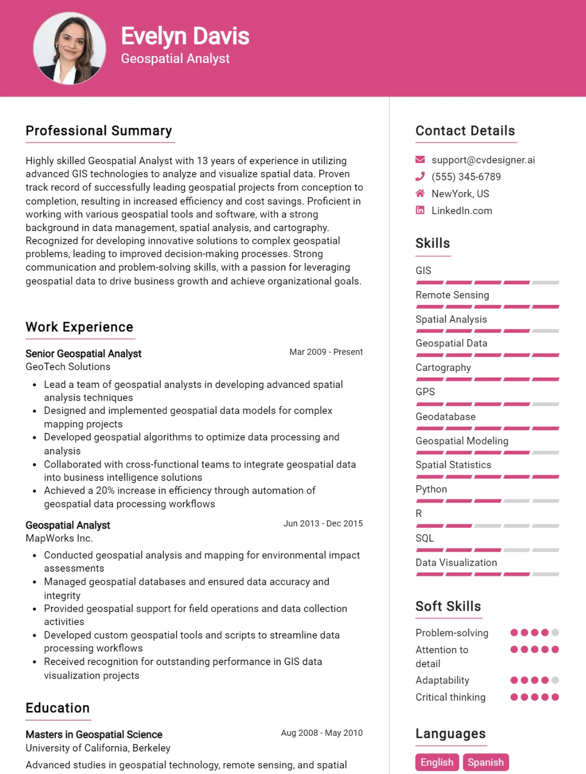
Sample Geospatial Analyst CV for Inspiration
John Doe
1234 Maple Street
San Francisco, CA 94101
john.doe@email.com
(555) 123-4567
LinkedIn: linkedin.com/in/johndoe
Professional Summary
Detail-oriented and analytical Geospatial Analyst with over 5 years of experience in utilizing Geographic Information Systems (GIS) and remote sensing technology to analyze spatial data and create actionable insights. Proficient in data visualization, spatial analysis, and geospatial modeling. Strong ability to collaborate with cross-functional teams to achieve project goals and enhance decision-making processes. Committed to leveraging geospatial data to address environmental and urban planning challenges.
Work Experience
Geospatial Analyst
City of San Francisco, San Francisco, CA
June 2020 – Present
- Conduct spatial analysis to support urban planning initiatives, enhancing decision-making through data-driven insights.
- Create and maintain detailed maps and data visualizations using ArcGIS and QGIS, facilitating effective communication of geographical information to stakeholders.
- Collaborate with city planners and environmental scientists to analyze land use patterns and assess the impact of proposed developments.
- Implement geospatial data collection methodologies, ensuring data accuracy and compliance with federal and state regulations.
- Develop automated workflows for data processing, reducing analysis time by 30%.
Junior Geospatial Analyst
Tech Solutions, Inc., San Jose, CA
July 2018 – May 2020
- Assisted in the development of GIS databases and performed data management tasks, ensuring high-quality spatial datasets for client projects.
- Analyzed satellite imagery and aerial photographs to assess land cover changes and environmental impacts.
- Supported the creation of interactive web maps and dashboards using ArcGIS Online, improving user accessibility to geospatial data.
- Conducted field surveys to collect ground-truth data, enhancing the accuracy of GIS models and analyses.
- Collaborated with senior analysts to prepare comprehensive reports summarizing findings and recommendations for clients.
Education
Master of Science in Geographic Information Systems
University of California, Berkeley
Graduated: May 2018
Bachelor of Science in Environmental Science
University of California, Davis
Graduated: May 2016
Skills
- Geographic Information Systems (ArcGIS, QGIS)
- Remote Sensing and Image Analysis
- Spatial Data Analysis and Modeling
- Data Visualization (Tableau, Power BI)
- Programming Languages (Python, R)
- Database Management (SQL, PostGIS)
- Project Management and Collaboration Tools (Trello, Slack)
- Strong Analytical and Problem-Solving Skills
Publications
- Doe, J., & Smith, A. (2021). "Assessing Urban Heat Islands in San Francisco Using Remote Sensing Data." Journal of Environmental Management, 250, 109-117.
- Doe, J. (2019). "Utilizing GIS for Sustainable Urban Development." Proceedings of the International Conference on Geospatial Technologies, 45-52.
Certifications
- GIS Professional (GISP) – Geospatial Certification Institute, 2019
- Esri Technical Certification: ArcGIS Desktop Professional, 2020
- Certified Remote Sensing Specialist, 2021
References Available Upon Request
Geospatial Analyst CV Writing Tips
When crafting a CV for a Geospatial Analyst position, it’s essential to highlight both your technical skills and your analytical abilities in a clear and organized manner. Start with a professional summary that showcases your expertise in geospatial technologies, data analysis, and problem-solving skills. Tailor your CV to the job description by using keywords relevant to the role and demonstrating how your experiences align with the employer’s needs. Remember to include specific projects or accomplishments that illustrate your proficiency with GIS software, remote sensing, and data visualization techniques. A well-structured CV that emphasizes your qualifications and practical experience will help you stand out in a competitive job market.
CV Writing Tips for Geospatial Analysts:
- Utilize Keywords: Incorporate relevant keywords from the job description to pass through Applicant Tracking Systems (ATS) and catch the hiring manager's attention.
- Showcase Technical Skills: Highlight your proficiency in GIS software (e.g., ArcGIS, QGIS), programming languages (e.g., Python, R), and data visualization tools (e.g., Tableau).
- Quantify Achievements: Whenever possible, use numbers and statistics to quantify your accomplishments, such as the size of datasets managed or improvements in efficiency.
- Include Relevant Certifications: List any certifications you hold, such as GIS Professional (GISP) or Esri Technical Certification, to validate your expertise.
- Detail Projects: Provide specific examples of geospatial projects you have worked on, including your role, the technologies used, and the outcomes achieved.
- Emphasize Analytical Skills: Highlight your ability to analyze complex datasets, draw insights, and present findings clearly to both technical and non-technical stakeholders.
- Tailor Your CV for Each Application: Customize your CV for each position by aligning your skills and experiences with the specific requirements of the job.
- Keep it Professional: Use a clean, professional format, ensuring that your CV is easy to read and free of grammatical errors or typos.
Geospatial Analyst CV Summary Examples
As a Geospatial Analyst, your CV summary should effectively highlight your skills, experience, and contributions to the field. Here are several examples of effective CV summaries tailored for this role:
Dynamic and detail-oriented Geospatial Analyst with over 5 years of experience in GIS mapping and spatial analysis. Proficient in utilizing ArcGIS and QGIS software to create innovative solutions for environmental and urban planning projects. Strong analytical skills and a passion for data-driven decision-making.
Results-driven Geospatial Analyst with a solid background in remote sensing and geospatial data interpretation. Skilled in conducting complex spatial analyses and generating detailed reports to support stakeholders in making informed decisions. Committed to delivering high-quality work within tight deadlines and collaborating effectively with interdisciplinary teams.
Highly motivated Geospatial Analyst with expertise in geostatistics and data visualization. Experienced in managing large datasets and employing advanced GIS techniques to solve real-world problems in transportation and land use planning. Adept at communicating complex geospatial concepts to non-technical audiences.
Innovative Geospatial Analyst with a strong foundation in data management and spatial modeling. Proficient in Python and R for automating workflows and enhancing analytical capabilities. Proven track record of improving project outcomes through effective use of GIS technologies and methodologies.
Detail-oriented Geospatial Analyst with extensive experience in environmental monitoring and resource management. Specializes in integrating geospatial data with statistical analyses to inform conservation strategies. Recognized for strong problem-solving abilities and a collaborative approach to project management.
Build a Strong Experience Section for Your Geospatial Analyst CV
As a Geospatial Analyst, your experience section is crucial in showcasing your technical expertise, analytical skills, and project contributions. Here are some compelling examples of work experience descriptions that highlight your proficiency in geospatial technologies and methodologies:
- Developed and maintained geospatial databases using ArcGIS and QGIS, ensuring data accuracy and accessibility for various departments, leading to a 30% improvement in data retrieval times.
- Conducted spatial analysis and modeling to support urban planning initiatives, utilizing satellite imagery and GIS tools to identify land use patterns, driving informed decision-making for city development projects.
- Collaborated with cross-functional teams to design and implement a geospatial data visualization dashboard, enhancing stakeholder engagement and enabling real-time data analysis for environmental impact assessments.
- Analyzed complex geospatial datasets to identify trends and patterns related to climate change, resulting in the successful publication of findings in a peer-reviewed journal and presentations at national conferences.
- Executed field surveys and remote sensing projects to collect geospatial data, employing advanced GPS technology and aerial imagery to enhance the accuracy of land resource assessments.
- Provided technical support and training to staff on GIS software and tools, fostering a culture of data-driven decision-making across the organization and improving overall geospatial literacy.
- Managed the integration of new geospatial technologies and tools, including machine learning algorithms, to automate data processing workflows, reducing analysis time by 50% and enhancing project efficiency.
- Participated in the development of a comprehensive geospatial strategy for disaster management, utilizing predictive modeling to identify high-risk areas and optimize resource allocation during emergency response efforts.
Geospatial Analyst CV Education Examples
A Geospatial Analyst plays a crucial role in analyzing spatial data to support decision-making across various sectors. A strong educational background in relevant fields is essential for success in this role, equipping individuals with the necessary skills to interpret and manipulate geospatial information effectively. Below are examples of educational backgrounds that are highly relevant for a Geospatial Analyst:
- Bachelor's Degree in Geography
This program typically covers physical and human geography, spatial analysis, and the use of Geographic Information Systems (GIS), providing a foundational understanding of how geographic data influences various phenomena. - Bachelor's Degree in Environmental Science
This degree often includes coursework in spatial analysis, remote sensing, and environmental modeling, equipping graduates with the skills needed to analyze environmental data with a geospatial perspective. - Master's Degree in Geographic Information Science (GIScience)
A specialized program focused on advanced GIS techniques, remote sensing, and spatial data analysis. This degree prepares graduates for high-level analytical roles involving complex geospatial datasets. - Bachelor's Degree in Urban Planning
This field of study emphasizes spatial analysis within urban environments, teaching students how to leverage geospatial tools to address urban development challenges and policy planning. - Certificate in Remote Sensing or GIS
These programs offer targeted training in specific tools and techniques used in geospatial analysis, allowing individuals to enhance their qualifications and gain practical skills in data collection and analysis.
Skills to Highlight in Your Geospatial Analyst CV
As a Geospatial Analyst, your expertise lies at the intersection of geography and technology, enabling you to transform complex spatial data into actionable insights. Highlighting a blend of both soft and hard skills on your CV is crucial to showcase your versatility and proficiency in this dynamic field. Below is a curated list of essential skills that can elevate your application and demonstrate your suitability for the role.
Soft Skills:
- Analytical thinking
- Problem-solving
- Attention to detail
- Communication skills
- Team collaboration
- Time management
- Adaptability
- Critical thinking
- Creativity
- Interpersonal skills
Hard Skills:
- Geographic Information Systems (GIS) proficiency
- Remote sensing techniques
- Spatial data analysis
- Cartography and map design
- Programming languages (e.g., Python, R)
- Database management (e.g., SQL)
- Data visualization tools (e.g., Tableau)
- Surveying and field data collection
- Geospatial modeling and simulation
- Familiarity with GIS software (e.g., ArcGIS, QGIS)
Geospatial Analyst CV Format
When crafting a CV for a Geospatial Analyst position, it’s crucial to highlight your expertise in spatial data analysis, GIS software proficiency, and project experience. A well-structured CV can set you apart from the competition, showcasing your skills and achievements effectively. The best format for your CV can vary depending on your career level—entry-level, mid-level, or senior-level positions each require tailored approaches.
For entry-level positions, a chronological format is often best, emphasizing education and relevant internships. Mid-level analysts may benefit from a combination format that highlights both skills and work experience. Senior-level candidates should opt for a functional format that showcases leadership roles and project management skills.
- Start with a professional summary that outlines your expertise in geospatial analysis and your career objectives.
- List your technical skills, including proficiency in GIS software such as ArcGIS, QGIS, and data analysis tools.
- Highlight relevant work experience, focusing on specific projects where you utilized geospatial technologies to solve problems or improve processes.
- Include certifications or training in geospatial analysis, GIS technologies, or related fields.
- Showcase your ability to work with diverse datasets and collaborate with cross-functional teams to deliver insights.
- Add a section for any publications or presentations related to geospatial analysis, demonstrating your thought leadership in the field.
For more detailed guidance on CV formats, visit the cv format resource.
Common Mistakes to Avoid in a Geospatial Analyst CV
When crafting a CV for a Geospatial Analyst position, it's essential to highlight your skills and experiences effectively. A well-structured CV can set you apart from other candidates, but there are common pitfalls that many applicants fall into. Avoiding these mistakes can significantly enhance your chances of landing an interview and showcasing your qualifications for the role.
- Neglecting to tailor your CV: Failing to customize your CV for each job application can make it generic and less appealing to recruiters.
- Overloading with technical jargon: Using excessive technical language without explanation can alienate non-technical hiring managers.
- Ignoring relevant soft skills: Not highlighting soft skills such as communication, teamwork, and problem-solving can diminish your appeal.
- Listing responsibilities instead of achievements: Focusing solely on job duties rather than quantifiable achievements can make your CV less impactful.
- Using an unprofessional format: Choosing a cluttered or overly complex design can distract from the content and make it hard to read.
- Failing to include key software and tools: Omitting essential geospatial tools and software proficiency can lead to missed opportunities.
- Lacking specific examples: Not providing concrete examples of projects or analyses can weaken your claims of expertise.
- Using passive language: Employing passive voice instead of active language can make your contributions seem less dynamic and engaging.
- Neglecting to proofread: Spelling and grammatical errors can undermine your professionalism and attention to detail.
- Not including continuing education: Failing to mention relevant certifications or ongoing training can suggest a lack of commitment to professional growth.
Key Takeaways for a Geospatial Analyst CV
- Start with a clear, professional summary that highlights your experience and key skills as a Geospatial Analyst.
- Include relevant qualifications such as degrees in geography, GIS, remote sensing, or related fields.
- List your technical proficiencies, including software tools like ArcGIS, QGIS, ERDAS Imagine, and programming languages such as Python or R.
- Emphasize your experience with data collection and analysis, showcasing specific projects that demonstrate your ability to interpret geospatial data.
- Highlight your proficiency in mapping techniques and spatial analysis, providing examples of how you’ve applied these skills in previous roles.
- Include certifications that are relevant to geospatial analysis, such as GIS Professional (GISP) or Esri Technical Certification.
- Showcase your problem-solving abilities by detailing specific challenges you have addressed using geospatial methodologies.
- Mention your experience with database management systems and spatial databases like PostgreSQL/PostGIS or Oracle Spatial.
- If applicable, include soft skills such as teamwork, communication, and project management, as they are vital in collaborative environments.
- Tailor your CV to align with the job description, using keywords that match the skills and experiences requested by potential employers.
- Don’t forget to create a cover letter that complements your CV, and explore a variety of cover letter templates to find one that fits your style.
- Use a professional CV builder to ensure your CV layout is clean, organized, and visually appealing, making it easy for hiring managers to read.
Build your CV in minutes
Use an AI-powered cv builder and have your cv done in 5 minutes. Just select your template and our software will guide you through the process.